Manganese crust survey
| Manganese crusts form a thin layer of mineral deposit that precipitates onto the surface of the seafloor at a rate of a few mm per million years. The crusts are thin, with thicknesses between 1 and 20cm, but have the potential to cover extremely vast regions of the seafloor, extending for several 10's of km. In this work, we aim to develop a way to survey the seafloor on these kinds of scales, by using a low flying underwater robot equipped with an acoustic sensor and a 3D visual mapping system to measure not only the distribution of the crusts on the seafloor, but also look beneath the seafloor and determine the thickness of the crusts. |
| To date, we have developed and deployed our measurement system at seamounts in the North west pacific and on the Phillipine sea plate. |
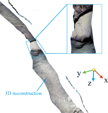
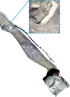
Example of 3D reconstruction with overlaid acoustic thickness measurements
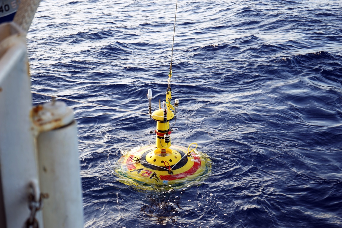
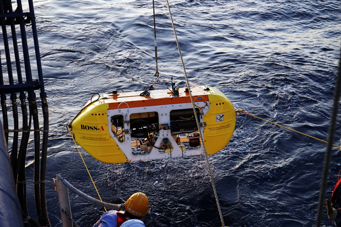
The ASV ABA (left) and the AUV "BOSS-A" being deployed for acoustic and 3D visual survey of Manganese crusts in the NW Pacific
Expeditions
2015
- NT15-03 AUV acoustic survey and 3D mapping at #5 Takuyo seamount and Katayama seamount: Multivehicle operation using the AUV BOSS-A, the ASV ABA, the ROV Hyperdolphin and the R/V Natsushima, Chief Scientist: Blair Thornton, Jan. 2015
2013
- NT13-13 Acoustic survey and 3D mapping at #5 Takuyo seamount using the ROV Hyperdolphin and the R/V Natsushima, Chief Scientist: Blair Thornton, June. 2013
≤2012
- NT12-25 Acoustic survey and 3D mapping at Higashi Oki-daitou seamount using the ROV Hyperdolphin and the R/V Natsushima, Chief Scientist: Akira Usui, Sept. 2012
- NT12-05 Acoustic survey and 3D mapping at #5 Takuyo seamount using the ROV Hyperdolphin and the R/V Natsushima, Chief Scientist: Blair Thornton, Feb. 2012
- KY11-02 Leg2 3D mapping at Ryusei seamount using the ROV Hyperdolphin and the R/V Natsushima, Chief Scientist: Akira Usui, Feb. 2011
- NT10-11 Acoustic survey and 3D mapping at #5 Takuyo seamount using the ROV Hyperdolphin and the R/V Natsushima, Chief Scientist: Blair Thornton, July 2010
- KY10-04 3D mapping at Teisi knoll using the AUV/ROV Tuna sand and R/V Kaiyo, Chief Scientist: Tamaki Ura, March 2010
- NT09-02Leg2 3D mapping at #5 Takuyo seamount using the ROV Hyperdolphin and the R/V Natsushima, Chief Scientist: Tetsuro Urabe, Feb. 2009

