マンガンクラスト調査
|
100万年に数mmの速度で海底面に付着するマンガンクラストは、堆積物が少ない平頂海山などを厚さ1~20cmで被覆します。ここでは、広範囲に渡って、連続的にクラストの量を調べるのに、クラスト層の厚さを計測する超音波装置"MilMilマンガン"と、面的な広がりを調べる3次元画像マッピング装置"seaXerocks"を開発しいます。 |
|
これらを、海中ロボットに搭載して、低高度から調査するシステムと、計測するデータの解析手法の研究を進めています。今まで南鳥島の近くにある第5拓洋海山、九州パラオジャンクションにある流星海山と東沖大東海山などでフィールド調査を実施しています。 |
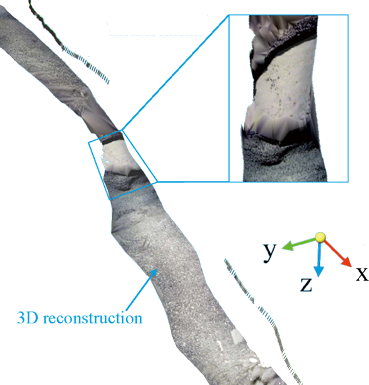
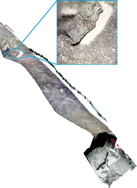
Example of 3D reconstruction with overlaid acoustic thickness measurements
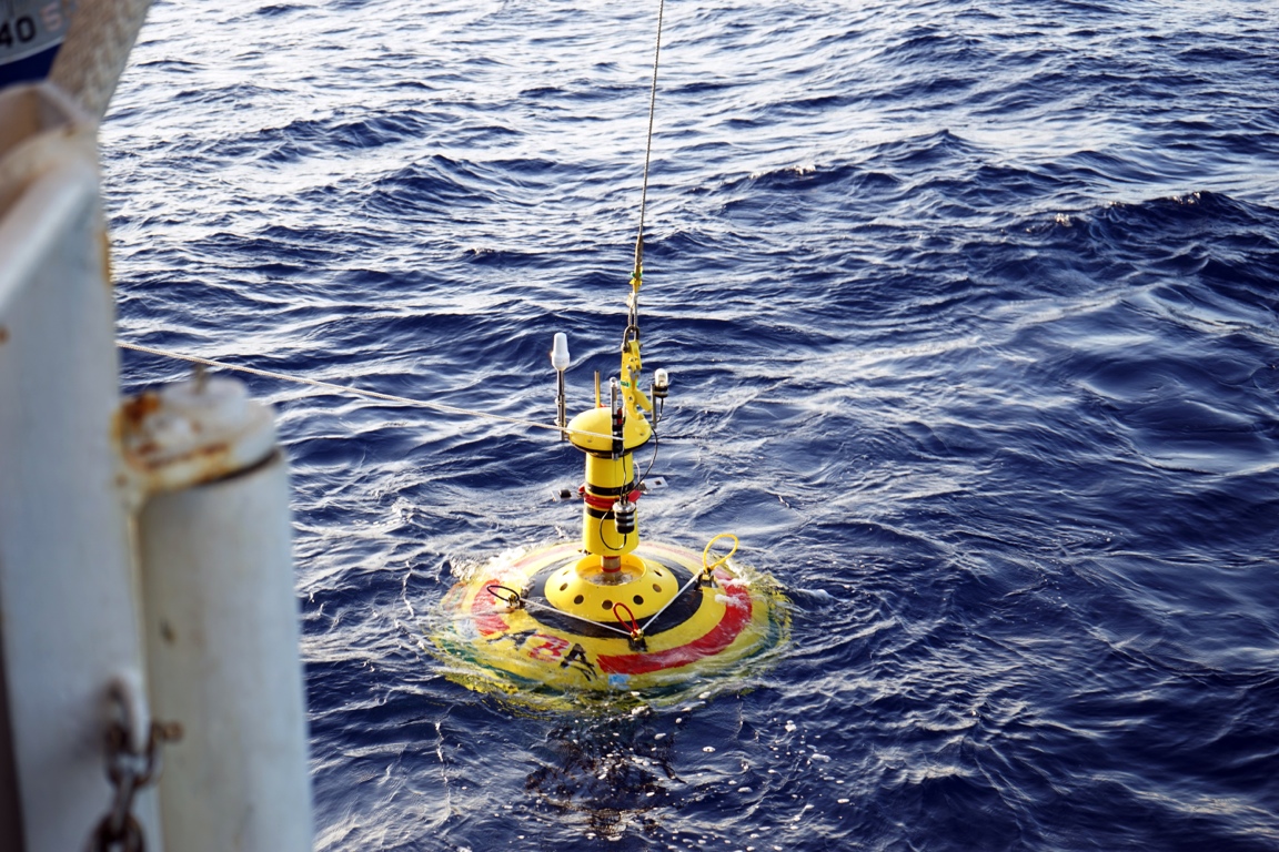
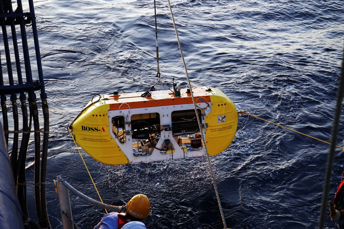
The ASV ABA (left) and the AUV "BOSS-A" being deployed for acoustic and 3D visual survey of Manganese crusts in the NW Pacific
Expeditions
2015
- NT15-03 AUV acoustic survey and 3D mapping at #5 Takuyo seamount and Katayama seamount: Multivehicle operation using the AUV BOSS-A, the ASV ABA, the ROV Hyperdolphin and the R/V Natsushima, Chief Scientist: Blair Thornton, Jan. 2015
2013
- NT13-13 Acoustic survey and 3D mapping at #5 Takuyo seamount using the ROV Hyperdolphin and the R/V Natsushima, Chief Scientist: Blair Thornton, June. 2013
≤2012
- NT12-25 Acoustic survey and 3D mapping at Higashi Oki-daitou seamount using the ROV Hyperdolphin and the R/V Natsushima, Chief Scientist: Akira Usui, Sept. 2012
- NT12-05 Acoustic survey and 3D mapping at #5 Takuyo seamount using the ROV Hyperdolphin and the R/V Natsushima, Chief Scientist: Blair Thornton, Feb. 2012
- KY11-02 Leg2 3D mapping at Ryusei seamount using the ROV Hyperdolphin and the R/V Natsushima, Chief Scientist: Akira Usui, Feb. 2011
- NT10-11 Acoustic survey and 3D mapping at #5 Takuyo seamount using the ROV Hyperdolphin and the R/V Natsushima, Chief Scientist: Blair Thornton, July 2010
- KY10-04 3D mapping at Teisi knoll using the AUV/ROV Tuna sand and R/V Kaiyo, Chief Scientist: Tamaki Ura, March 2010
- NT09-02Leg2 3D mapping at #5 Takuyo seamount using the ROV Hyperdolphin and the R/V Natsushima, Chief Scientist: Tetsuro Urabe, Feb. 2009

